


|

|

|
Morehead City Forecast
Forecast issued by NWS at Friday, April 17, 2026 at 10:14 AM ET
| Time | Weather | Temp | Rain Chance |
|---|---|---|---|
| This Aft | Sunny | 80°F | 0% |
| Tonight | Mostly Clear | 64°F | 0% |
| Sat | Sunny | 80°F | 0% |
| Sat Night | Partly Cloudy | 67°F | 0% |
| Sun | Showers And Thunderstorms Likely | 77°F | 60% |
| Sun Night | Showers And Thunderstorms Likely | 48°F | 60% |
| Mon | Sunny | 67°F | 10% |
| Mon Night | Mostly Clear | 48°F | 0% |
MONTHLY CLIMATOLOGICAL SUMMARY for APRIL 2026Mandy Farms CITY: Morehead City STATE: NCELEV: 10 LAT: 034:43:32 LONG: 0076:45:37
|
Atlantic Beach Tides: 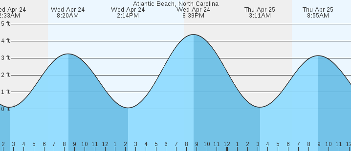
Click Here for Tide Table |
| Severe Weather Outlooks |
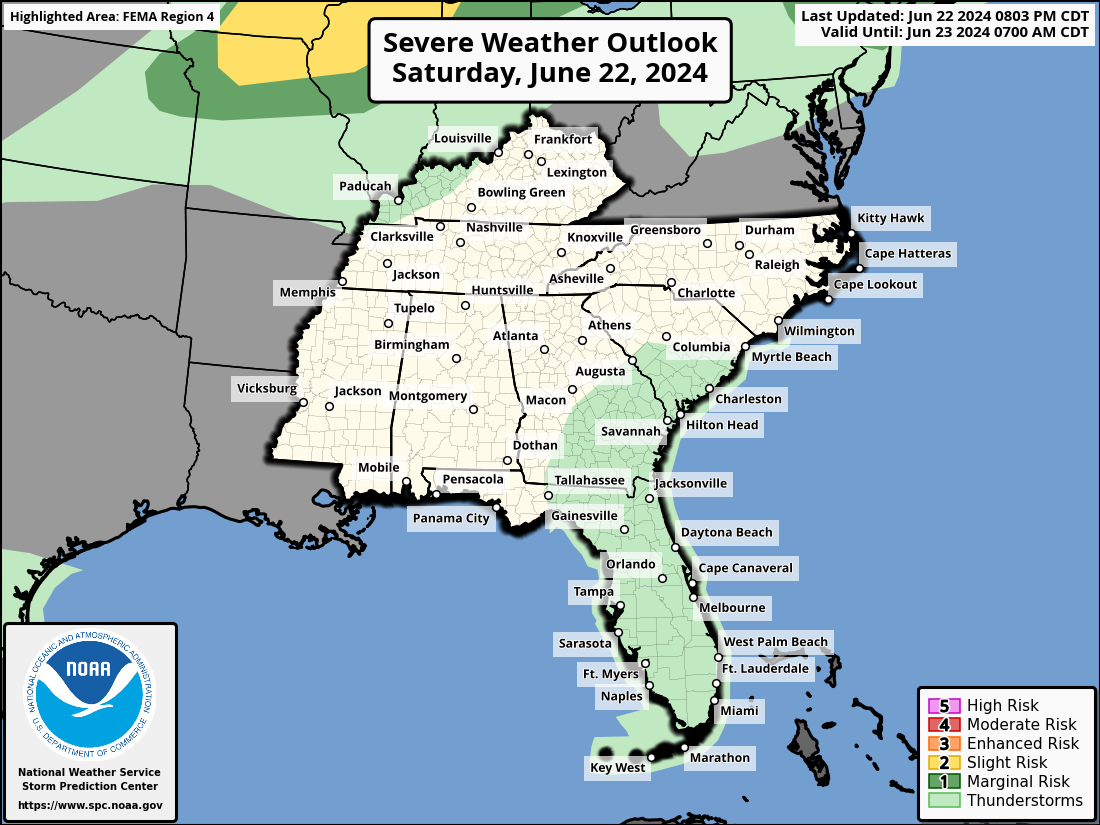
Day One Severe Outlook |

Day Two Severe Outlook |

Day Three Severe Outlook |

Day Four Outlook |

Day Five Severe Outlook |

Day Six Severe Outlook |

Day Seven Severe Outlook |

Day Eight Outlook |
| Lightning Data |
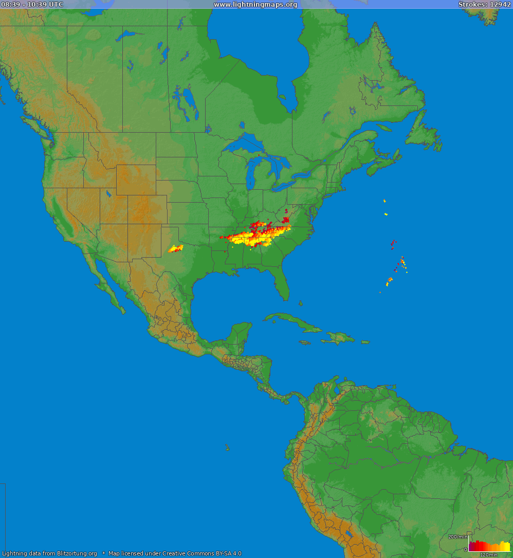
National Lightning Strikes |
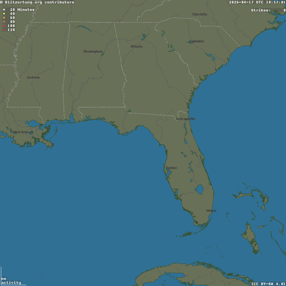
Southeastern Lightning Strikes |

Northeast Lightning Strikes |