



Select NOAA-NWS Forecast Office Text Products
(Product availability varies with seasons, forecast office, and weather.)
Hazardous Weather Outlook for Morehead City, NC
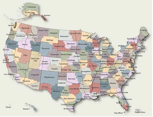
To Select Another NWS Office Click on Map or Choose from List
|
| Select Forecast Office: | Select Product: |
643 FLUS42 KMHX 260030 HWOMHX Hazardous Weather Outlook National Weather Service Newport/Morehead City NC 830 PM EDT Sat Jul 25 2026 NCZ203-205-270030- Northern Outer Banks-Hatteras Island- 830 PM EDT Sat Jul 25 2026 ...MODERATE RIP CURRENT RISK IN EFFECT FROM 8 AM EDT SUNDAY THROUGH SUNDAY EVENING... This Hazardous Weather Outlook is for eastern North Carolina. .DAY ONE...Tonight. Hazardous weather is not expected at this time. .DAYS TWO THROUGH SEVEN...Sunday through Friday. Please listen to NOAA Weather Radio or go to weather.gov on the Internet for more information about the following hazards. Moderate Rip Current Risk. A cold front will move through Tuesday night and bring an increased chance of thunderstorms, a few which may be strong to severe. .SPOTTER INFORMATION STATEMENT... Spotter activation is not expected at this time. $$ NCZ029-044>047-079>081-090>092-094-193>196-198-199-204-270030- Martin-Pitt-Washington-Tyrrell-Mainland Dare-Greene-Beaufort- Mainland Hyde-Duplin-Lenoir-Jones-Pamlico-Northern Craven- Southern Craven-West Carteret-East Carteret-Inland Onslow- Coastal Onslow-Ocracoke Island- 830 PM EDT Sat Jul 25 2026 This Hazardous Weather Outlook is for eastern North Carolina. .DAY ONE...Tonight. Hazardous weather is not expected at this time. .DAYS TWO THROUGH SEVEN...Sunday through Friday. A cold front will move through Tuesday night and bring an increased chance of thunderstorms, a few which may be strong to severe. .SPOTTER INFORMATION STATEMENT... Spotter activation is not expected at this time. $$ |
Previous Hazardous Weather Outlooks may be found at
NWS Morehead City, NC (MHX) Office Hazardous Weather Outlooks.
(Click 'Previous Version' there to view past versions successively.
Some may differ only in time posted.)
Products Courtesy of NOAA-NWS
NWS Information Parsing Script by Ken True at Saratoga Weather - WFO and Products Scripts by SE Lincoln Weather.
Mapping by Curly at Michiana Weather and by Tom at My Mishawaka Weather.